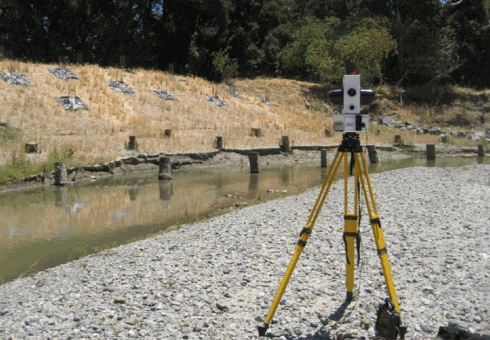
Surveying and Terrestial LiDAR Mapping
Storesund Consulting uses Terrestrial LiDAR, RTK GPS, and Total Station survey equipment for field survey campaigns. Compared with traditional field survey techniques, Terrestrial LiDAR offers the advantage of being a remote sensing technology that does not require direct physical measurements for limited access areas, rapid data collection, and monitoring of both physical and biological features. Additionally, Terrestrial LiDAR offers site context far superior to traditional survey techniques, enabling clash detection during design and enhanced ecological monitoring following construction of restoration projects.
- RTK GPS, Total Station, Terrestrial LiDAR
- Topographical surveys & site plans
- Preliminary project layout and construction staking
- Erosion & scour mapping & monitoring
- Structural/BIM scanning
- Construction documentation scanning
- Industrial facility scanning